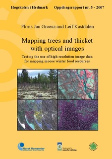
Mapping trees and thicket with optical images : testing the use of high resolution image data for mapping moose winter food resources
Research report
Permanent lenke
http://hdl.handle.net/11250/133621Utgivelsesdato
2008-08-08Metadata
Vis full innførselSammendrag
English: This study describe the use of HySpex hyperspectral images and QuickBird satellite images for
the classification of forest and vegetation in Stor-Elvdal, especially forest and vegetation that are a resource
for moose browsing.
Field data was gathered on several tree species and vegetation types in the study area. The sample points were
exactly georeferenced with the use of GPS and Vexcel orthophotos. A HySpex flight strip (25 cm resolution)
and a QuickBird satellite image (60 cm resolution) of the exact same area were used for the classification.
Both images have been orthorectified. No images were atmospherically corrected. For the QuickBird image,
the Normalize Difference Vegetation Index and several texture images were calculated. For the HySpex
image two data reduction methods were applied: Principal Component Analysis and Minimum Noise Fraction
transformation.
Both images were classified by an object oriented approach with use of the software eCognition. After a
segmentation procedure, a Nearest Neighbour (NN) classification method was applied. In addition to the
Nearest Neighbour classification, Support Vector Machines (SVM) and a Decision Tree (DT) classification
was performed on the same classes and sample data.
The overall classification accuracy of the QuickBird classification was about 40%. Regrouping the classing
into ‘pine, ‘spruce’, ‘deciduous’, and ‘other groundcover’ improved the result up to 78%. There was little
difference between the results of the NN, the SVM, and the DT classifiers for the Quickbird images. The
overall classification accuracy of the HySpex classification was about 63%. Regrouping the classes improved
the result to 76% (for the NN classifier) to 81% (for the SVM and DT classifiers). The HySpex classification
discriminated the classes ‘pine’ good, ‘spruce’, and ‘willow’ reasonably well, while the QuickBird classification
only discriminated the class ‘pine’ reasonably well (over 70% accuracy).
We were not able to map the browsing pressure with the limited field data we had available in this study. We
did not used methods to identified single tree crowns, but we believe tree crown identification could improve
the result for moderate browsed trees. For hard browsed pine trees the biomass of needles are very low and
the trees will therefore be difficult to indentify from above, even on images with ground resolution down to
15 cm.
The classification results can be reasonably useful for the mapping of moose browsing resources. The results
could be improved by taking more and more accurate field samples, by using extended hyperspectral image data, by adding existing maps as support for the classification, or by using LIDAR (Light Detection And
Ranging) height data.
More research is needed to investigate whether it is possible to map moose browsing pressure, and we
suggest using a combination of LIDAR and optical images for mapping the browsing resources available for
moose. Norsk: Denne undersøkelsen omhandler bruken av HySpex hyperspektrale bildedata og Quickbird
satellittdata til klassifikasjon av skog, spesielt skog som er av betydning som beite for elg. Bildedata er hentet
fra et mindre område i Stor-Elvdal kommune.
Vi samlet inn feltdata for flere treslag og vegetasjonstyper i studieområdet. Punktene ble nøyaktig kartfestet
med GPS og avmerket på detaljert ortofoto (15 cm bakkeoppløsning fotografert med Vexcel UltraCam).
Vi klassifiserte en HySpex flystripe (25 cm bakkeoppløsning) og et Quickbird satellittbilde (60 cm bakkeoppløsning).
Bildedataene var nøyaktig ortokorrigert. Vi korrigerte ikke for atmosfærisk avvik. For Quickbird
dataene beregnet vi en normalisert vegetasjonsindeks (NDVI) og flere teksturbilder ble avledet. For HySpex
bildet ble datamengden redusert ved bruk av prinsipal komponentanalyse (PCA) og med minimum støy
andel transformasjon (MNF). Begge bilder ble klassifisert med en objektorientert tilnærming med bruk
av eCognition software. Etter segmentering benyttet vi nærmeste nabo (NN) som klassifikasjonsmetode.
I tillegg utførte vi klassifikasjon basert på support vektor maskin (SVM) og beslutningstre (DT) på det
samme datasett som NN klassifikasjonen.
Den gjennomsnittlige klassifikasjonsnøyaktigheten fra analysene på Quickbird dataene var ca 40%. Ved
reduksjon av antall klasser til furu, gran, løvtre og annen bakkevegetasjon ble resultatet forbedret til 78%.
Det var liten forskjell mellom algoritmene NN, SVM og DT i analysene av Quickbird dataene.
Den gjennomsnittlige klassifikasjonsnøyaktigheten fra analysene på HySpex dataene var ca 63%. Reduksjon
til færre klasser forbedret resultatet til 76% for NN klassifikasjonen og til 81% med SVM og DT som
klassifikatorer. I klassifikasjonen med HySpex data ble klassene furu, gran, selje godt identifiserte, mens for
Quickbird var det kun klassen furu som ble godt (over 70% nøyaktighet) identifisert.
Det var ikke mulig å kartlegge elgbeiteskade med de begrensede feltdata vi hadde tilgjengelig i dette
prosjektet. Resultatet av klassifikasjonen er rimelig brukbar for a kartlegge elgbeite. Resultatet kan bli
forbedret med et større feltmateriale, ved å benytte hyperspektrale data fra en større del av spekteret, ved å
benytte eksisterende kartdata som støtte i klassifikasjonen eller ved å kombinere LIDAR (Light Detection
And Ranging) høyde data med de optiske bildedataene. Med disse forbedringer tror vi det er mulig å
kartlegge elgbeite nøyaktig, men det trengs mer forskning for å undersøke hvor nøyaktig beiteskader fra elg
kan kartlegges.
Vi anbefaler at videre undersøkelser fokuserer på å benytte både LIDAR og optiske flerkanalsbilder i
kartlegging av beiteressurser for elg.
Serie
Oppdragsrapport05/2007
